The Kingdom of Ulster is one of the Kingdoms of Hibernia, a political division among the Changelings of Ireland.
Overview[]
The counties of Donegal, Monaghan, and Cavan, together with the six counties which make up Northern Ireland: Armagh, Down, Antrim, Derry, Tyrone, and Fermanagh, make up the ancient province of Ulster. Occupying the northeastern corner of Ireland, these lands constitute some of the most heavily industrialized parts of the island as well as some of its most picturesque and striking landscapes.
Donegal[]
For a town with a population of less than 2,500, Donegal has an impressive history, beginning with its name: Dún na nGall or “fortress of foreigners.” Founded as a Viking garrison town, Donegal later came under control of the O’Donnell clan. Hough O’Donnell destroyed his castle before joining other Irish nobles in their exile during the “Flight of the Earls.” In the 1600s, the English “planted” Donegal with loyal Protestant settlers.
In the town square stands an obelisk honoring the Four Masters, a group of Franciscan friars who wrote the Annals of the Four Masters, an illuminated manuscript detailing Celtic history from just before the Flood to their own time. The ruins of Donegal Abbey where the Four Masters lived (and presumably illuminated) lies along the banks of the River Eske.
Just outside of town, the Donegal Craft Village contains a collection of shops that display the work of local crafters.
Glenveagh National Park and the Derryveagh Mountains[]
The Derryveagh Mountains rise in the center of Donegal County. Part of the same seismic convulsions that gave birth to the Caledonian ranges in Scotland and the Appalachians in North America, these granite and quartzite upthrusts of stone rise above a landscape of gentle hills, valleys, lakes, and marshes. Twin-peaked Errigal Mountain, the highest of the Derryveagh range at 2466 feet, dominates the surrounding lands.
Part of the Derryveagh mountain range lies within the grounds of Glenveagh National Park, a three-mile preserve centered on Glenveagh Castle, a fanciful Victorian recreation of a medieval castle, perched on the shore of Lough Veagh. Beyond the castle, the parklands include formal gardens, thick woodlands, steep cliffs, and a marshy valley called the Poisoned Glen (from a poisonous plant that once proliferated there). Ireland’s largest population of red deer dwells within the parklands.
- See also The Forest of the Hidden King
Slieve League []
Slieve League, Europe’s tallest cliffs, forms a massive rock wall along Donegal’s coast. A few places along the waterline provide access to the shore by boat, but in general, the cliffs present a vertical barrier to the waves that crash headlong against its unyielding stone. The light of the setting sun strikes directly onto the cliffs, awakening colors hidden within the rock: warm ochre, red, brown, amber, and in some place cobalt, verdigris, yellow, and green. This rainbow of hues comes from the varied rocks that make up the structure of the cliffs, including quartzites, slates, mineral ores, and schists.
Formidable winds lay across the top of the Slieve League, making it a risky (though rewarding) spot for viewing the panoramic scenery outward to the horizon and downward to the ocean nearly 2,000 feet below. A number of sea birds swoop and dive along the cliffs, and at times the air is filled with gulls, jackdaws, and choughs.
Tory Island[]
Located of the northwest coast of Donegal, Tory Island is the home of a dedicated community of Gaelic-speakers who have their own king (an elected position) and who steadfastly treasure their relative independence from the rest of the world. A thriving school of primitive artists, founded in 1968 by local painter James Dixon, figured prominently in the island’s resistance to a government campaign to remove residents to the mainland.
It’s not always possible, due to the frequently bas weather that stirs up the waters, to make the passage from Meenlaragh across Tory Sound to the island, which is, itself, barren and windswept, barely supporting its small population. In addition to the pair of towns, East Town and West Town) that house most of the island’s inhabitants, Tory Island also contains a number of old sites, including the ruins of St. Columbkille’s monastery with its primitive Tau Cross. Visitors planning on an overnight should bring a sleeping bag and hope for floor space in the island’s one hostel or hotel.
- See also Balor's Tower
Glencolumbkille[]
The tiny village of Glencolumbkille (pop. 260), only a few miles from the northern end of Slieve League, lies along the rocky harbor of Glen Bay. The surrounding countryside contains more than 40 ancient sites, many of them associated with St. Columba. Atop a cliff overlooking the village, the House of St. Columba contains stone formations which supposedly served the ascetic saint as bed and chair. On the saint’s feast day, groups of barefoot pilgrims make a 2-mile circuit, referred to as An Turas (the journey), of 15 medieval crosses, known as the Stations of the Cross.
Just outside the town, the Folk Village serves as a living museum depicting traditional Irish lifestyles and crafts.
- See also Glenlea
Belfast[]
Located on the northeastern coast of Ireland, the city of Belfast, capital of Northern Ireland, occupies a stretch of low land near the mouth of the River Lagan, which runs through the city on a north-south axis. With a population of 305,000 people, it is Ireland’s second largest city (Dublin is larger) and its biggest industrial center. Unlike so many other Irish cities, Belfast is relatively young, founded as a busy port town in the 18th century and achieving the official status of “city” only in 1888.
The name Belfast comes from “Béal Feirste,” which means “the mouth of the sandy ford,” and aptly describes the geography of the region. The land the city now occupies once formed part of the holdings of the O’Neill clan, whose fort was destroyed in the 12th century. John de Courcy, a Norman knight, built a castle to replace the fort and a town sprang up around it. Later, the area became the property of an English nobleman, Sir Arthur Chichester, whose son became the Earl of Donegal. In 1613, the town of Belfast received a charter from James I. The city became a haven in the 17thcentury for groups of Huguenots, who brought with them their linen-making skills.
Massive debts forced the second earl to place his properties on the market. A number of speculators bought the land along the banks of the Lagan, hired a trio of noted architects to design the city, and before long, a prosperous community hospitable to the growing linen and shipbuilding industries rose.
During the Irish Civil War, Belfast, with its close ties to England, became the center for resistance to Irish independence. With the treaty that created two countries out of one island, Belfast emerged as the undisputed capital of Northern Ireland. Its most famous role in history, however, has occurred during the last half of the 20th century, as the focus for the violent outburst of Republican activity and Unionist backlash collectively (and with typical Irish understatement) known as “the Troubles.”
Physically, Belfast is a city of contrasts. Impressive, castle-like structures such as the Renaissance style City Hall, the neo-Romanesque St. Anne’s Cathedral, the late Victorian Grand Opera House, and the Tudor-style main building of Queen’s University exist alongside modern office buildings, cramped row-houses, areas of small shops and pubs, and dingy slums… industrialization’s bane.
West Belfast contains two of the city’s most politically entrenched communities: the Protestant Shankhill Road, and the Catholic Falls Road. Both neighborhoods are made up largely of working-class families, both are deeply committed to their respective politics, and both are most keenly affected by the rise and fall of Belfast’s economic prosperity (or lack thereof).
Five miles southeast of the city’s center stands Stormont, a massive building constructed in an Anglo-Palladian style that exudes authority and control. Designed to house the Northern Ireland Parliament, Stormont remained the symbol of British rule until the Parliament was disbanded in 1972 in favor of the imposition of direct rule. Today, the building holds a number of government offices.
The Ulster Museum, near the Botanic Gardens and Queen’s University, displays a wealth of treasures recovered from the Girona, one of the ships of the Spanish Armada which foundered and sank near the Giant’s Causeway. Additionally, the museum holds many fine artifacts detailing the history, archaeology, and culture of Ulster.
Perhaps the most distinctive landmarks in Belfast are the twin cranes dubbed Samson and Goliath, the symbols of the Harland and Wolf shipyards, builders of great ocean-going ships, most notably the Titanic.
Chimeric Belfast[]
The Kithain of Belfast move in and out of their dreams with unsettling frequency, due to the sometimes-overwhelming sense of futility caused by the Troubles and the often-depressed economic conditions of the city. Many Belfast changelings did not awaken to their faerie natures until recently, when the cease-fire brought with it the hope for lasting peace between the two warring factions within the city. Thus, Kithain who might have undergone their Chrysalis as childlings became wilders, while would-be wilders experienced a delayed transformation, emerging as grumps near the autumn of their lives as children of the Dreaming.
Belfast’s Freeholds[]
King Finn of Ulster has handed out a number of freeholds within the city to various nobles loyal to him. The freehold of Duke Lorenzo, a grand manor house built on an estate on the outskirts of Belfast, typifies the grandiose ambitions of its lord. Chimerically ostentatious, it both attracts and repels those who visit it. Needless to say, the manor house has changed drastically since the ousting of Duke Kestry, its former occupant.
Other freeholds in Belfast attest to the variety of the city’s Kithain population. An abandoned toy store in West Belfast belongs to the Belfast Runners, a group of the city’s childlings, many of them street urchins, who occupy themselves by carrying messages from one freehold to another, ignoring the invisible boundaries of religion and politics.
The Storyteller’s Circle, which includes several eshu, a pooka, and a clurichaun, occupies a building near the Linen Hall Library and makes frequent use of the Library’s collection of rare books.
The Midnight Crawlers, a motley of consisting of a neo-punk sidhe wilder musician and her entourage of Kithain groupies, make their home in a small, out-of-the-way pub called Splendour Falls Road, where they serve as house band for the freehold and attract many of the city’s younger fae.
The rule for Ulster freeholds is that they reflect the people who live there. Thus, they involve warmth and safety against the long Winter nights. Alcohol and fighting also feature strongly in a town where violence and long periods of idleness are frequent intruders upon the fading dreams of its inhabitants.
- See also The Brick Glade
Giant's Causeway[]
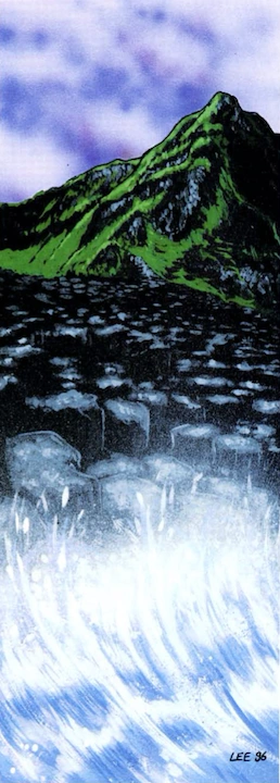
County Antrim’s north coast holds one of the world’s most peculiar and bizarre natural structures, the Giant’s Causeway. Formed from the interaction of volcanic basalt with chalk and limestone, the 37,000 or so rectangular, circular, and polygonic pillars of stone thrusting up from the sea provide proof of just how eerie and unearthly parts of Ireland really are.
Naturally, the Causeway now belongs to the National Trust, which both preserves and controls access to it, posting signs along designated walks intended to guide tourists by the most prominent rock formations, which include the Wishing Chair, Lady’s Fan, Giant’s Organ, Giant’s Cannon, and Chimney Point, among others. Despite the potential hazards posed by the sometimes-slippery rock, visitors delight in scrambling, stepping, or leaping across the irregular surface of the columns, some of them barely big enough to stand on.
Finn’s Road[]
Legends associate the Causeway with Finn MacCool, who is said to have erected it either as a means of crossing to the home of his lover, a Scottish giantess, or as a bridge to reach his enemy, the Scottish giant Fingal. A third (and most typical of Irish humor) story maintains that Finn built the Causeway to get to Scotland for a drink.
Whatever the truth of the matter, the Causeway still holds a repository of Glamour, although it is sometimes difficult to sense and, when it is, it feels somehow tainted, as if poisoned by the Troubles that have so long beset the nearby lands. Some Kithain, even those with keen faerie sight, are unable to detect even the faintest traces of the fickle magic that surrounds them. The Wishing Chair, a formation of rocks on the Causeway that resembles a small seat, is believed to have the power to grant wishes.
The Causeway is, in fact, the origin and terminus of a great faerie trod known as “The Causeway Road,” although passage through it is often bleak and cold. The erratic nature of the structure’s Glamour may be due to the fact that use of the trod “ties up” the magic of the Causeway so that it does not bleed into the mortal world at certain times.
Whether or not the Causeway once served some other purpose has been forgotten by both commoners and nobles, although some of the sidhe maintain that it used to be a gathering place used as a dancing ground by the ancient Seelie Court and for darker purposes by their Unseelie counterparts. It is possible that King Meilseoir or Queen Merala remember the Causeway’s true function, but it is just as likely that the long centuries of forgetfulness have erased those memories from their minds.
[]
Navan Fort, a large, circular megalithic structure atop a hill west of the city of Armagh, was once the coronation site of the ancient kings of Ulster as well as the headquarters for the Red Branch Knights, of whom Cuchulainn was the most famous. Its physical appearance consists of a large, grass-covered mound protected by an earth rampart and a surrounding ditch. The remains of what might have been a sizable, round wooden structure show evidence of ritual destruction by fire.
Although the site has been excavated and attracts tourists, many of them are content to visit the nearby interpretive center in lieu of a direct experience. Thus, some of its original Glamour still remains untapped.
- See also Emain Macha
Derry[]
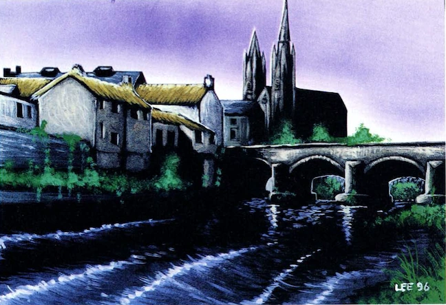
The walled city of Derry (or Londonderry) lies along the banks of the River Foyle. The prolific St. Columba founded a monastery in the 6th century by the river near an oak grove (or doire). This became the foundation of the city. In a familiar pattern, the Vikings arrived and later the English. When James I instituted the plantation of Ulster, he encouraged the craft guilds of London to set up shop in the city of Derry, at which time it acquired the name of Londonderry. During the time of Cromwell’s war against the Catholic troops loyal to James II, the city of Londonderry found itself under siege. Only the courage of a group of apprentice boys, who closed the gates of the city, kept Londonderry from falling to the Royalists.
During the Troubles which escalated during the late 1960s, Derry became a center for the civil rights movement and suffered its share of violence between Protestants and Catholics. The Catholic area known as the Bogside, located outside the walls of the city, soon became known as “Free Derry” and was a hostile environment for British soldiers sent to quell the growing disturbances. The bitterness engendered by the deaths that marked January 30, 1972 as Bloody Sunday still taints the memories of many of the city’s inhabitants, Protestant and Catholic alike.
Today, Derry is a divided city in many ways. Since the Troubles, most of the Protestant population has relocated along the east bank of the city, leaving the west bank and much of the city center to its now Catholic majority. Derry is experiencing a resurgence of prosperity and vitality, but many Protestants have taken themselves “out of the loop” in the process.
Within the 17th century walls surrounding the old city lie St. Columb’s Cathedral (the first Catholic church built after the Plantation), the Victorian style Guildhall, O’Doherty’s Tower (the home of the Tower Museum), and the Craft Village, a recent addition to the city as part of an urban revival plan. The walls themselves are perhaps the prime attraction for visitors, since their relatively intact nature makes them the best example of city fortifications of their period.
Chimeric Derry[]
From her splendid mansion outside of the city, Geraldine Quigley, the Duchess of Derry, rules over the local Kithain. Despite her loyalty to King Finn, she is preoccupied with the peculiar problems of her city and works assiduously to bring together Kithain representatives of both factions of the population. This is not an easy task, for Derry’s changelings are notorious for their stubbornness and loyalty to whatever cause they espouse.
Among the motleys within the confines of Derry are the Apprentices, a mixed group of boggan and nocker crafters who have a small freehold near the Craft Village, and the Bogside Militia, an even odder collection of redcaps and trolls who have banded together to “keep the peace” according to their definition of the term. Their freehold lies in an abandoned house in the Bogside.
Duchies[]
- Duchy of Emain Macha
- Duchy of Belfast
- Duchy of Antrim
- Duchy of Down
- Duchy of Armagh
- Duchy of Fermanagh
- Duchy of Tyrone
- Duchy of Derry
- Duchy of Cavan
- Duchy of Donegal
- Duchy of Monaghan
References[]
- CTD: Immortal Eyes: Court of All Kings, pp. 73-79.